museum-digitalwestfalen
CTRL + Y
en
Drilandmuseum Karten und Pläne [2021-087]
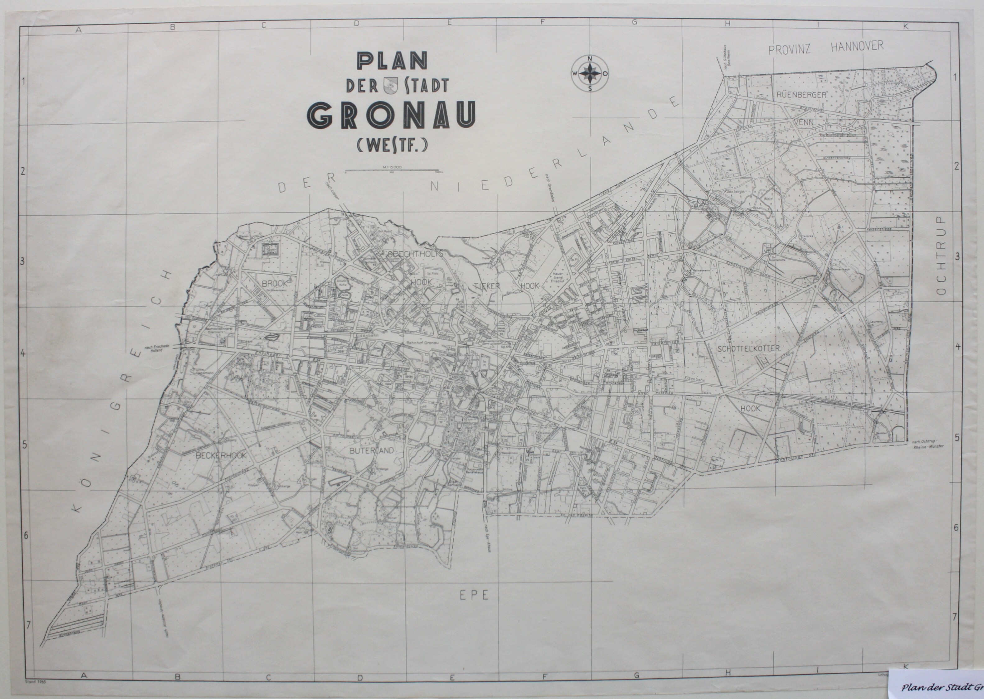
Landkarte: "Plan der Stadt Gronau (Westf.)" (Drilandmuseum CC BY-NC-SA)
Provenance/Rights: Drilandmuseum / Emil Schoppmann (CC BY-NC-SA)
1 / 2 Previous<- Next->

Landkarte "Plan der Stadt Gronau (Westf.)"

Contact Cite this page Data sheet (PDF) Calculate distance to your current location Archived versions Mark for comparison Graph view

Description

Querrechteckige Karte der Stadt Gronau mit schwarzer Farbe auf Papier gedruckt. Die Vermessungskarte zeigt die Bebauung, Straßenverläufen und Flurnamen. Die angrenzenden Gebiete sind freigelassen und mit "Königreich der Niederlande", "Provinz Hannover", "Ochtrup" und "Epe" bezeichnet. Mittig steht die Überschrift "Plan der Stadt Gronau (Westf.)". Darunter der Maßstab 1: 15.000 und ein geordneter Kompass. Die Karte zeigt den Zustand des Jahres 1965 und wurde im Verlag Willy Größchen in Dortmund gedruckt.

Material/Technique

Papier / Karton

Measurements

H 50,0 cm; B 70,8 cm

Map
Drilandmuseum

Object from: Drilandmuseum

Die Geschichte der Grenzstadt Gronau, die kulturhistorischen Beziehungen im Dreiländer-Gebiet und ein ganz besonderes, 140 Millionen Jahre in die...

Contact the institution

[Last update: ]

Usage and citation

The textual information presented here is free for non-commercial usage if the source is named. (Creative Commons Lizenz 3.0, by-nc-sa) Please name as source not only the internet representation but also the name of the museum.
Rights for the images are shown below the large images (which are accessible by clicking on the smaller images). If nothing different is mentioned there the same regulation as for textual information applies.
Any commercial usage of text or image demands communication with the museum.