museum-digitalwestfalen
CTRL + Y
en
Drilandmuseum Karten und Pläne [1986-284]
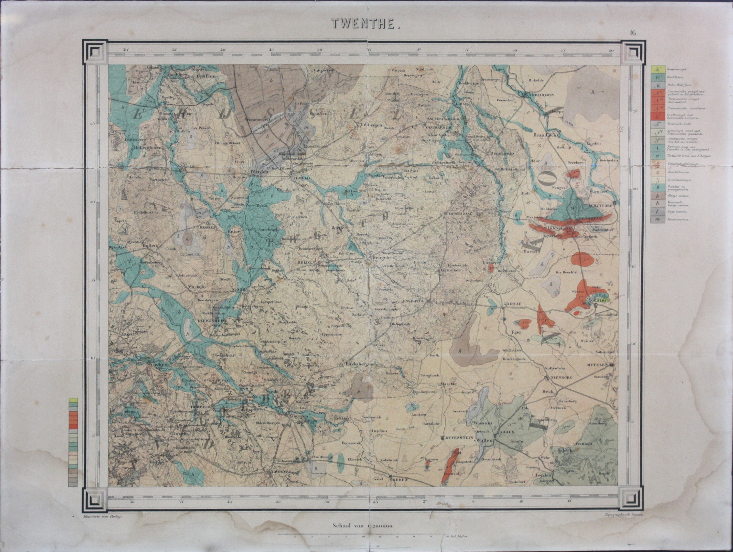
Landkarte: Twenthe (Drilandmuseum CC BY-NC-SA)
Provenance/Rights: Drilandmuseum / Emil Schoppmann (CC BY-NC-SA)
1 / 2 Previous<- Next->

Landkarte Twenthe

Contact Cite this page Data sheet (PDF) Calculate distance to your current location Archived versions Mark for comparison Graph view

Description

Farbige Lithographie auf Karton, die von einem schwarzen Rahmen eingefasst wird. Zu sehen ist eine geologische Karte der Stadsregio Twente, rund um die Städte Almelo, Enschede und Hengelo. Sie grenzt im Osten an den niedersächsischen Landkreis Grafschaft Bentheim und das nordrhein-westfälische Münsterland. Maßstab 1: 200.000. Unten links bezeichnet mit: "Ministerie van Oorlog"; rechts: "Topographisch Burnau". Herausgebene vom Verlag W. C. H. Staring.

Material/Technique

Papier

Measurements

H 32,5 cm; B 43,1 cm

Drilandmuseum

Object from: Drilandmuseum

Die Geschichte der Grenzstadt Gronau, die kulturhistorischen Beziehungen im Dreiländer-Gebiet und ein ganz besonderes, 140 Millionen Jahre in die...

Contact the institution

[Last update: ]

Usage and citation

The textual information presented here is free for non-commercial usage if the source is named. (Creative Commons Lizenz 3.0, by-nc-sa) Please name as source not only the internet representation but also the name of the museum.
Rights for the images are shown below the large images (which are accessible by clicking on the smaller images). If nothing different is mentioned there the same regulation as for textual information applies.
Any commercial usage of text or image demands communication with the museum.